
-

URGENT: Testimony Needed THIS TUESDAY to Create an East Maui Water Authority
This coming Tuesday, Maui has a chance to move toward achieving greater control over our own water security. The Maui County Council’s Government Relations, Transparency and Ethics (GREAT) committee…
Continue reading -

Testimony Needed on Friday, 9/24: EMI Water Lease EIS is Inadequate!
URGENT TESTIMONY ALERT! Maui Tomorrow believes that East Maui Irrigation’s Final Environmental Impact Statement (FEIS) does not adequately disclose the negative impacts of their proposed 30-year…
Continue reading -
Ha‘ikū and Pā‘ia Residents Ask to Be Heard Before County Council Votes on Maui Island Water Plan
A special meeting of Board of Water Supply (BWS) was held this week, at which Ha‘ikū and Pā‘ia residents complained that they haven’t been consulted on the Maui Island…
Continue reading -
Help Maui Tomorrow Defend the Public Trust Water Doctrine
Act Now to let Our Streams Flow! We have til December 30 to raise $5000 in matching funds Donate
Continue reading -
After years of waiting, East Maui hui’s case finally being heard
From: OHA KAHULUI (Mar. 2, 2015) — Today, the State Commission on Water Resource Management (Water Commission) will re-engage a case that’s been languishing for years. It involves ʻohana from Honopou to…
Continue reading -
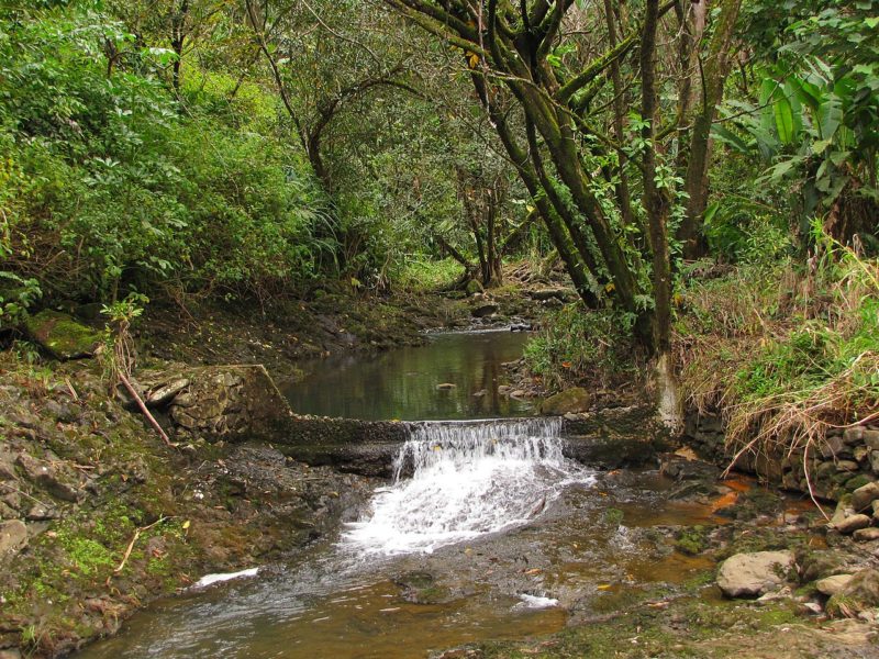
Na Wai Eha water releases less than required?
According to measurements by the Commission on Water Resource Management, releases totalled only 5.47 million gallons instead of the required 10 million gallons. Wailuku Water Company head Avery Chumbley told…
Continue reading -
DLNR’s Press Release on Na Wai ‘Eha Agreement
MAUI PARTIES REACH AGREEMENT IN NA WAI ‘EHA AMENDED INTERIM INSTREAM FLOW WATER CASE DEPARTMENT OF LAND AND NATURAL RESOURCES NEIL ABERCROMBIE, GOVERNOR WILLIAM *-J. AILA, JR. CHAIRPERSON FOR IMMEDIATE RELEASE April 21, 2014 HONOLULU…
Continue reading -
EarthJustice: Down to Earth – Hawai’i Water
From the article: For more than 10 years, the Hawaiʻi office has been involved in a massive legal effort to restore freshwater, taken by sugar plantations, to…
Continue reading -
Maui Stream Flows Below Normal
Excerpted from a Maui News article The latest report from the U.S. Geological Survey shows that stream flow in Maui County and statewide is below normal…
Continue reading
- 1
- 2